
Mitra Djamal
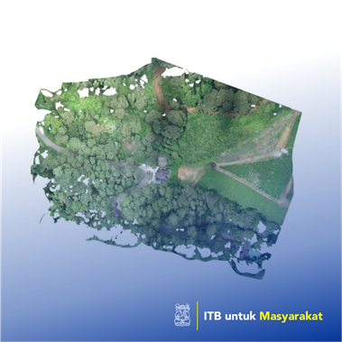
Geographic Information Systems (GIS) or GIS (GeoGhraphic Information System) are a system that can carry out the collection, storage, analysis and presentation of an object and phenomenon where the geographic location is an important characteristic in conducting analysis. In addition to geographical data needed, the important components of Laing in GIS include hardware, software and human resources that work effectively so that GIS can be implemented according to expectations. Furthermore, GIS has also been applied in agriculture. Agricultural commodities that are directly related to the advantages of agricultural products are expected to be increased with GIS technology assistance including the following applications: for monitoring agricultural production with land mapping for environmental pollution detection, monitoring plant conditions, potential predictions of agricultural products, the region attacked by pests , region ready for production, risk analysis of planting failure, appropriate planting period, calculation of rainfall on agricultural land, cropping pattern scenarios, plants and soil parameters, water content, mapping irrigation resources, fertilizer needs and other. In addition to being able to open opportunities for the potential for increasing farmer revenue through an increase in the position of its carrying position, the implementation of GIS in agriculture is expected to encourage the formation of local and national level agricultural information network and facilitate the documentation of agricultural information at the local level so that it can be accessed globally. The agricultural commodity information system in question is the existence of location, position coordinates, production area, price information, fluctuations in price changes, total production, distribution of dissemination of production and others.
Application of appropriate technology
The Bandung and surrounding areas have around more than 100 thousand hectares of agricultural areas that have the potential to increase income and economy both farmers or countries. But unfortunately, some obstacles are often faced by farmers or groups of farmers in the Bandung region, for example, it is difficult to market agricultural products, unpredictable crop failure, it is difficult to get business assistance funds and so on. All of this happens because of the lack of information obtained by consumers, the government or researchers in agriculture on the condition of the farmers.