


Umar Fauzi
Indonesia lies in an area known as a ring of fire where the dynamics of the earth's crust in the zone is very complex and is a challenge to adapt to these conditions. The process in the earth layer allows Indonesia to have a variety of minerals, but also a variety of natural disasters. Regions with complex tectonic dynamics certainly cannot avoid earthquake events, these dynamics also produce mountains with steep slopes plus a climate with high rainfall can be a cause of landslides. The number of volcanoes is certainly accompanied by its activities in the form of eruptions. The natural disaster above is a challenge that must be faced and encourage mastery related to this matter is very important in addition to contributions to help the affected community is needed. The Earth Physics and the Complex System (KK-FBSK) FMIPA-ITB has carried out one of its missions to contribute to natural disaster mitigation through community activities.
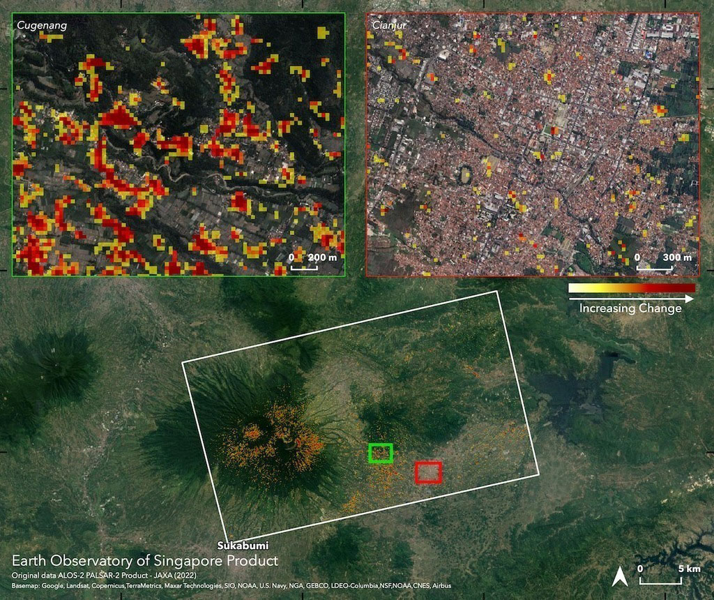
One of the disasters that just happened was the Cianjur earthquake Quite close to the ITB campus. For this reason, the role of ITB is very important and awaited by the community, for that the Earth Physics Coordinates and complex systems with one of the vision is natural disaster mitigation, carrying out the theme activities of community service in 2023 to help the earthquake affected area in Cianjur - West Java.
The contribution of FBSK KK that has been made includes:
- Mapping for the search for clean water using electromagnetic methods in the Cijedil area.
Explanation of Physics to High School In Cianjur, namely SMA1 Cianjur, Vocational School Permata Insani, Cendikia Cianjur Islamic High School, SMK. Pilot Project helps SMA/SMK. There are 3 types of high school: SMA Negeri, International Boarding School High School, Agriculture Vocational School. It is hoped that there will be a pilot project that can be developed online and massively to other schools in the future.
The objectives of this stage have been achieved
Providing debriefing to high school and vocational students. Provide information on the potential for subsurface water in an earthquake affected area.