


Vera Sadarviana
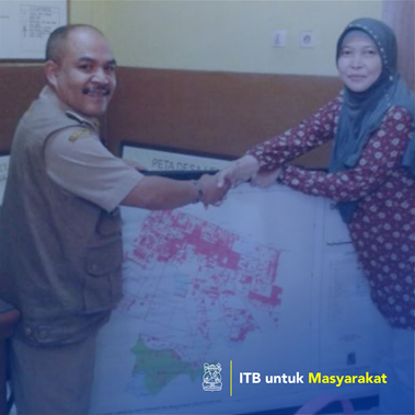
Villages or kelurahan are seen as the starting point for empowering regional potential, solving problems in society, and the smallest community that must be considered by the welfare. The next development is a lot of expansion of the village area. Just as with Lembang Village, Lembang District, West Bandung Regency. Because of such rapid development there is a discovery and solving of administrative areas. This expansion certainly contains implications for building new areas optimally. The implication of this is about the boundaries of the village area. In Law No. 32/2004, mentioned the need for determination and assertion of regional boundaries, in this case provinces and districts / cities. The same thing needs to be done for the village area. The latest regulations are Law Number 6 of 2014 Article 8 paragraph 3 items F stated that the boundaries of the village stated in the form of village maps stipulated in regent / mayor regulations. With it own a village map, village officials can find out the boundaries of the village, identify and inventory of village potential or assets as the first step for the planning of the village potential empowerment. In addition, with village maps, it can also be seen things that can be an obstacle in the efforts to empower its potential, so that the steps can be done. The village often doesn't know exactly the boundaries. Even though the regional boundaries between villages are next to the initial step to identify and inventory of assets owned. The scope of this PM activity is making maps with indicative territory areas of the village originating from the Indonesian earth map combined with land cover information from orthogonal spot images / high-resolution tall. Another technical aspect that must get attention is a scale, geodetic datum, map projection, and grid system. The final result in the form of a village map with indicative region is socialized to village officials and village representatives (village head, RW chairman) in the map making socialization forum and product delivery. The village map will be revised if the definitive regional boundaries have been published by the Ministry of Home Affairs in the form of a Ministerial Regulation.
Implementation of social care activities in the form of education / counseling / mentoring
Lembang Village Office already has a photo map and map of village orientation in the Lembang sub-district area, but the technical aspects have not received attention, including the boundaries of Lembang Village. In addition, it is also constrained by the limitations of the knowledge of village officials and the community about the importance of village maps.