


Andri Hernandi
According to Ministerial Regulation No. 4 of 2016, there are details of the village scale local authority in the fields of health, infrastructure, public facilities, water, resettlement, and society. See village authority that cannot be separated from the importance of information about regional characteristics, Then spatial information is sought to be integrated into the village information system. Although full authority regarding land ownership and licensing is managed by the body National land, authority regarding land use tax liabilities managed by The district / city government and the Directorate General of Taxes, and the authority to regulate the living layout of an area regulated. By the Regional Development Planning Agency, the development of a land information system in a good village can help maintain the land system in the government. The village can provide land information in its area which can then be verified by every government institution / institution. This makes the implementation of government activities run efficiently. The land information system in the world has operating standards listed in International Standard Operation (ISO) 19152: 2012 which regulates land administration Domain Model (LADM) in the form of a land administration system pattern that contains Legal information, subject / person / organization, spatial units, survey data or identification of objects, Soil geometry data / topology (Lemmen, 2012). Therefore, ISO 19152: 2012 becomes Basis in developing administrative and land information systems in the village. ISO. 19152: 2012 will be adopted and tailored to the needs and local characteristics at village.
Application of appropriate technology, the application of writing
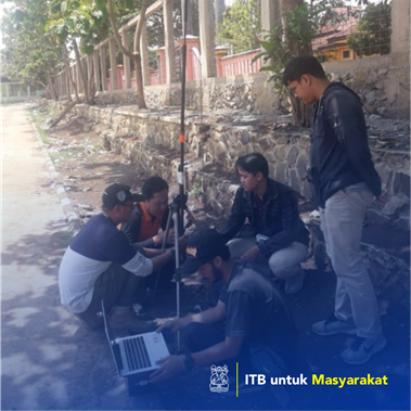
Pakutandang Village, Bandung Regency still manages village data in the form of digital and analog data so that it has not been integrated in a database. In fact, the data managed is not small, the data is in the form of population data, village potential data, land and building tax data, and other administrative data. In addition, villages do not have village maps and distribution of land ownership so that land management to support the activities of the Sustainability Development Goals (SDGs) in the village is difficult to do.