


Mohamad Nur Heriawan
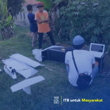
In order to support the development plan of the Regional Tourism in Kampung Areng, Wangunsari Village, Lembang District, West Bandung Regency, an integrated surface survey survey. The condition of the land and morphology of the investigation area which is the result of the weathering of volcanic material and in the form of bumpy hills will affect the potential for land use for certain cultivation plants (bamboo, pine, vegetables) and potential landslides. The distribution of land cover, surface temperature zone, soil moisture, and the level of acidity (pH) which is measured directly in the field will help the cultivation land development plan. While air photos and digital elevation models (DEM) are produced from direct measurements with drones equipped with the results of field geological mapping will help zoning landslide landslides. This community service activity will be useful to help develop a decent land development as well as the education area. So that in the future it is expected to increase the welfare of the surrounding community through the power of the land potential.
How many artworks / design / architecture / regional planning
In order to support the development plan of the Regional Tourism in Kampung Areng, Wangunsari Village, Lembang District, West Bandung Regency, an integrated surface survey survey.